English
Home
Services
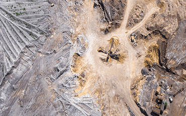
Aerial Mapping
Engineering Grade Surveys
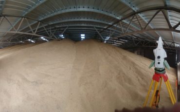
Laser Scanning
GIS, Remote Sensing & Spatial Analysis
Thermal Inspections & Mapping
Aerial Gas Detection/ Pipeline Monitoring
Case Studies
Engineering
Municipality
About Us
About Ventus
Customer FAQs
Contact Us
Home
Services
Aerial Mapping
Engineering Grade Surveys
Laser Scanning
GIS, Remote Sensing & Spatial Analysis
Thermal Inspections & Mapping
Aerial Gas Detection/ Pipeline Monitoring
Case Studies
Engineering
Municipality
About Us
About Ventus
Customer FAQs
Contact Us
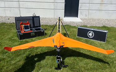
UAV/UAS Drone Services & Analysis
Home
Our Services
Aerial Mapping
Ventus Geospatial leverages cutting-edge geomatics, remote sensing and GIS expertise to create ...
Read More
Seismic Surveying
The use of unmanned aerial systems (UAS) allows for the capture of ...
Read More
Aerial Gas Detection
Ventus Geospatial is a world leader in the successful development of the ...
Read More
Pipeline Monitoring
Ultra high-resolution aerial ortho-imagery, highly accurate digital topographic surveys, gas mapping and ...
Read More
Thermal Inspections & Mapping
High resolution thermal imagery coupled with RGB aerial mosaics and oblique photography ...
Read More
Data Processing
A Geographic Information System (GIS) is a computer system designed to capture, ...
Read More
Engineering Grade Surveys
Ortho-rectified imagery captured by ultra-high resolution cameras mounted on advanced unmanned aerial ...
Read More
Advanced Analytics
Ventus Geospatial leverages the latest in geomatics, Unmanned Aerial System (UAS) technology ...
Read More
GIS Mapping
Ventus Geospatial is a world leader in the successful development of the ...
Read More
Laser Scanning
Laser Scanners (Terrestrial or LiDAR) are capable of producing extremely accurate/precise point ...
Read More